.jpg)
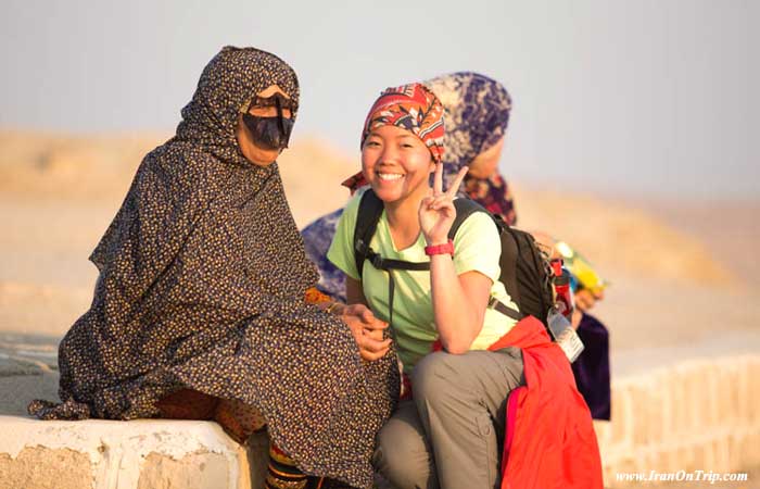
Qeshm Island Geopark
Qeshm Geopark
Location: South of Hormozgan province in Persian golf.
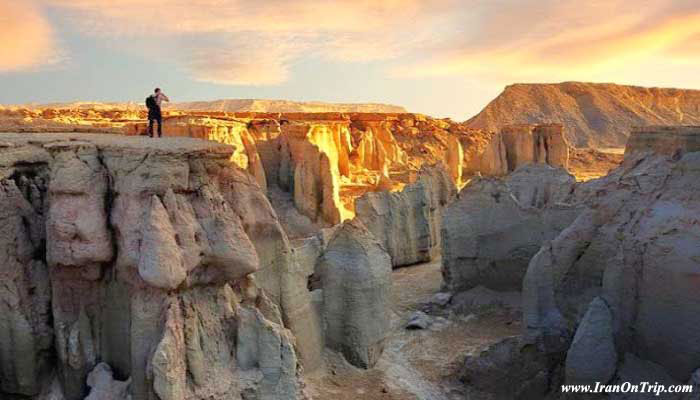
There is a mountain range across Qeshm Island whose height is rarely more than 300 meters. Its length, however, is almost as much as the island and about 110 km.
Mountains of Qeshm have a special situation. They are formed of horizontal and parallel sedimentary layers, and only at two points, the parallel disposition of layers has been disrupted due to presence of salt domes.
On the western side of the island, there is a salt dome, which is locally called Namakdan Mountain. Its height measures 395 m. and the rest of the mountains are not higher than 200 m. They are topped by a plateau with good vegetations. The mountains are surrounded by high walls which have been shaped into exquisite forms due to erosion resulting from wind and rain.
Iran’s first geopark in Qeshm
The plains, valleys, coasts and mountains of Qeshm Island are unique in terms of fauna and flora and display rare geological phenomena.
The western part of the island houses most valuable habitats as well as rare geological phenomena.
In addition to singular fauna and flora, that part of the island is also a display of unique geological phenomena which are of high value and beauty.
Natural statues and carvings, amazing mountains and folding of the Earth’s crusts, plateaus topping the mountains, columns formed by erosion, as well as various shapes carved out of the natural entities as a result of the work of natural elements have created beautiful natural statues in the form of a turtle, dog, lizard, hippopotamus, and even an angry man screaming.
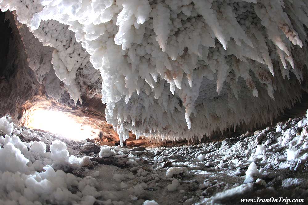
On the southern coasts of the western side of the island from the fishing port town of Salakh to Kani village (that is about 30 km of the island) there is no village, farm, or any other form of human activity. On the western part of the island, human presence as well as livestock breeding and agriculture has been rare since old times and is not remarkable even now. This part of the island is house to mangrove forests, salt domes, salt caves, spas, Chahkouh pass, Aali Pass, valley of statues as well as dozens of cliffs with strange shapes.
Due to natural beauty and richness of the island, especially its western part, serious measures have been taken to protect it and about 500 square kilometers have been set aside as a geopark.
The geological features of Qeshm Island and presence of rare geological phenomena was a good reason for officials to protect the western part of the island in the form of a geopark.
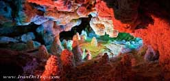
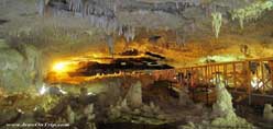
Chahkouh Pass
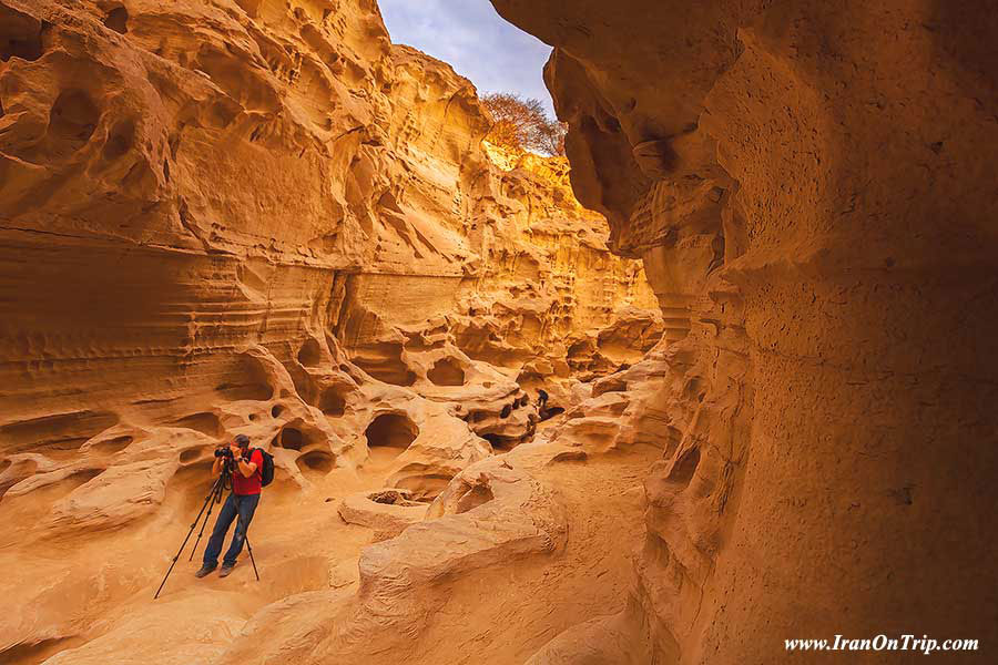
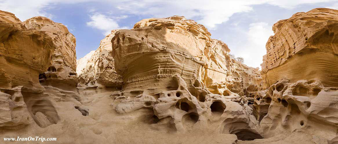
The amazing Chahkouh pass near East Chahou village will amaze all visitors with its corridors as well as surprising shapes on its walls. Similar geological phenomena have been found only in Germany, Britain, China, the United States and few other countries.
Chahkouh pass is the result of the erosion of sedimentary stones and has been less visited by tourists because it is still relatively unknown.
Chahkouh pass or ravine is located at Shahab district of Qeshm city and has 100 m deep. It is a display of sedimentary stones. The ravine is located 70 km from Qeshm city near East Chahou village on the western side of the northern coasts of the island and is considered one of its most important tourism attractions.
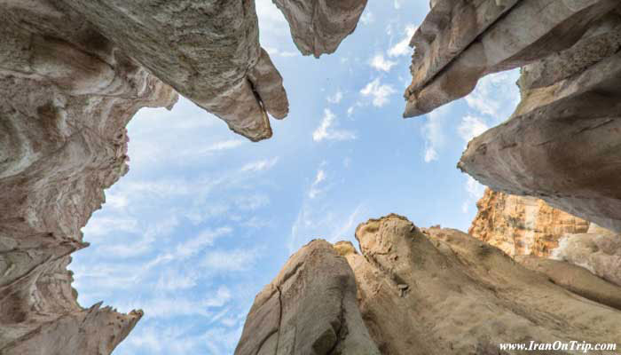
The amazing ravine is located at the heart of a stone mountain which looks like multiplication sign. Chahkouh is first wide and surrounded by high walls, but then becomes so narrow that it is difficult to pass through while the walls still remain high.
The ravine includes four straits where the walls nearly meet and are only about 0.5-2 m apart. It seems that the ravine and similar ravines around it have been formed through collapse of a big anticline which has also created the salt dome which is known as Namakdan (saltshaker).
Stones forming Chahkouh are mostly sedimentary limestone which are similar to Zagros Mountains range and are among three major stone categories present in the nature.
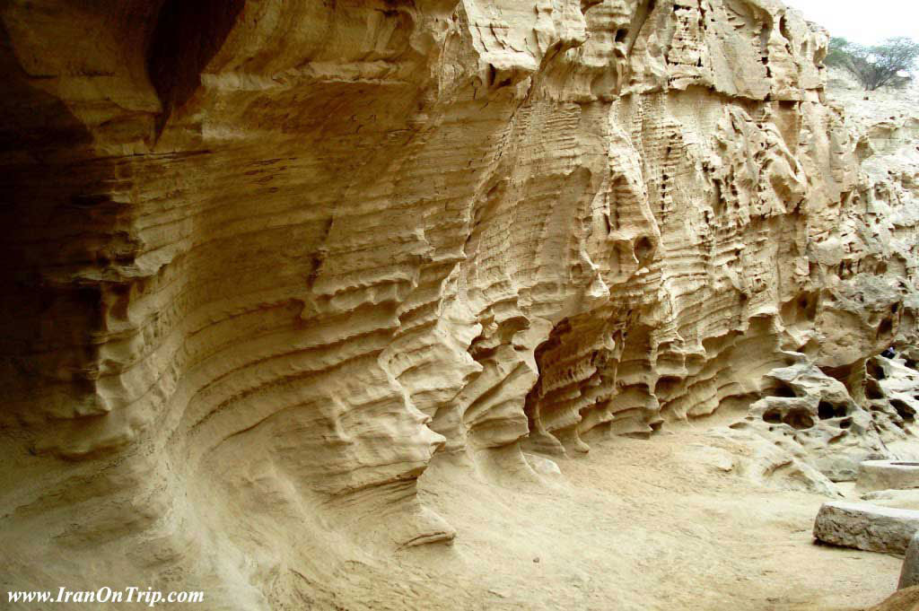
Water erosion has created long creases in the walls of Chahkouh ravine and has caused various pits which look like lens, spoons, and spheres. Presence of those creases and pits as well as stone carvings at the bottom of the ravine has made it into a natural wonder. Designs and shapes formed on the walls of the ravine are like dreams and look like the works of art.
Wind, rain, and heavy precipitation are the main factors which have created a lot of pits in the walls of Chahkouh. Stones forming Chahkouh are mainly made of lime or calcium bicarbonate which have been dissolved in the rain water and have given rise to small pits which have enlarged in millions of years and formed interesting corridors.
V-shaped slopes
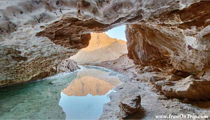
Near Chahou village, there are two perpendicular valleys with high walls. At the bottom of one of those valleys which runs roughly from north to south, there are shallow and semi-deep pits which look like wells where water is stored and used by locals.
The entrance of the valley is wider on the north with less slope and looks like “u”. As we move toward the south, the valley narrows and its slope increases so that, at the end it is v-shaped and difficult to pass and this proves that the valley has been made by floods.
There are many parallel creases on the walls of the valley some of which are deeper and look like spoons or funnels.
The walls are mostly made of weak limestone and signs of serious erosion and dissolution are evident, so that, there are many big and small pits across the whole walls. It seems that shallow water holes which are used by locals have been dug by man, but they are continuation of it which had been originally worked out due to dissolution of limestone. In fact, man has finished nature’s work. Along the main valley and the one perpendicular to it, there is a narrow water canal which has been apparently made to guide water from inside the valley into the water holes.
Since the valley has vertical and relatively high walls, presence of creases and lines resulting from erosion as well as semi-spherical and semi-ellipsoid pits have made it especially beautiful.
Why Chahkouh?
In conclusion, it should be useful to explain about naming of Chahkouh. The reason it has been called Chahkouh (meaning mountain of wells in Persian) is presence of water wells at the beginning of the valley. The locals have dug shallow wells and canals to channel water, which have doubled the beauty of the valley. Since this is an arid and warm region, storing fresh water is of high importance and those wells are used to store rainwater. The wells are old and have been used from ancient times to supply potable water to people living in that part of the island.
.....
.....
.....