.jpg)
Kish Island

About Kish Island
Kish Island is a beautiful island and touristic resort located on the north east of the Persian Gulf (Khalij-e Fars) about 17 km (10.2 miles) from the southern offshore of the mainland Iran.
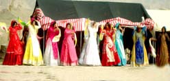
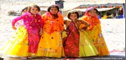
Kish Island,the pearl of the Persian Gulf, with an area of 90 square km (36 sq. miles), is known for being a beautiful resort in the Middle East and the Persian Gulf.Kish Island has relaxed laws as compared to the rest of Iran.If you catch up with an Iranian, Iranians are friendly and hospitable.
Kish is an Iranian island and city in the Persian Gulf, and is part of the Hormozgan province. Due to its status as a free trade zone, it is touted as a consumer's paradise, with numerous malls, shopping centres, tourist attractions, and resort hotels.
There is a Dolphin Park on the southeast side of the island, and scuba dive sites mainly on the south side: Dama Wreck, Grrek Wreck, Jurassic Park Reef, Big Coral Reef, Oyster bank, Southern Reef... and a little further Hendorabi Island.
Get in:
Note: No entry visa is needed to Kish
Foreign nationals need no entry visa at the authorized arrival and departure points of Kish Island. At Kish International Airport the officials will take your photograph, fingerprints, and stamp your passport, which allows you to stay up to 14 days on the Island. If you are western, you may be sternly questioned as to the purpose of your visit. Make sure to bring any and all verification paperwork including hotel reservations with phone numbers, etc.
By plane
Presently,in Kish Airport there are some international airlines that are active.The Popular airline that has domestic and international flights in Kish is "Kish Air".Kish Air has international flights to Dubai, Istanbul, Varna, Masqat, Abu Dhabi and Sharjah. Kish Air as well has domestic flights to the main cities in Iran.
Kish Airport: 4422100, 4422460
Kish Airline: 4423517, 4422030
Airport Passport Office: 422640
By car
Driving by car is an easy and smart option.But,there is only one route that will take you to Kish Island.If you are driving from Tehran,take care on the road and be alert about the highways and the walking pedestrians.
By bus
There are Private buses that will take you from Tehran and the main cities to Kish Island.
Private Buses
Private Buses is probably the safest way of travelling in Iran .Private Buses are inexpensive comparing to other countries in the Middle East or around the World.
By boat
There are boats that will take you from the cities of Bandar-e Abbas, Bushehr, Dubai and Chahbahar.
Get around
If,you are energetic walking is preferable or you can try the best Taxi service available all over Kish Island.But,most tourists prefer walking around Kish Island.
There are also good network of taxis but without meters. You have to clearly tell them the place and fix the fare in advance. Most taxis are toyota Camry's and are aircondioned. The normal fares are in the range of USD 2 to USD 5 depending upon the distance, which is not very long in any case, as the Island is small.
Harireh Taxi Service: 4420500
Touristic Attractions:
Kish Dolphin & Crocodole Park:This Dolphin Park is the unique ocean atrium in the Middle East, and visitors can enjoy spectacular Dolphin and other sea mammal shows in a family oriented atmosphere. Entrance Fee for tourists & visitors:US$ 30
The Green Tree Park: The Park with the oldest tree on the island. (Free)
Mysteries of the World Zoo: A Small Zoo with interesting and weird animals on display. Entrance Fee for tourists & visitors: US $2
Greek Ship: is a famous old ship resting on one of the shores of Kish. It has become a major tourist attraction is the past few years (Free)
Underground Town of Cariz
The Ancient Town of Harireh
Marjaan Beach Park
Giant Bird Sculpture: you can climb up inside of it!
and more...
The Beach
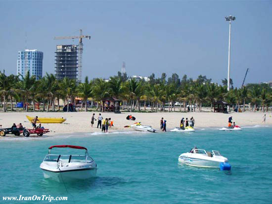
Snorkeling on the Beach is amongst the best in the world, while scuba diving offers an even more spectacular insight of life beneath the waters. A variety of other water sports are also available. Jet-skiing, sailing, fishing, parasailing, reef walking, coral viewing, boating and water skiing are just a few popular ways to spend the time and enjoy yourself during your visit to the Island. variety of other water sports are also available. Kish coast is one of the least dangerous coasts in the world.Kish has beautiful white silvery sand beaches for relaxing walks. Other activities include going to concerts and plays frequently held on the Kish Summer Cinema and shopping and touring in the malls. Learning To Dive Is Fun, Fast and Easy !
New to Scuba Diving or Not, Kish Diving Center has Dive Courses for You in Kish Island, Iran
Scuba diving: It's always something you wanted to try. Your friends do it. You've seen it on TV. So why not actually try it? In just one day you can discover the wonders of the underwater world. Swim with sea turtles, make new friends and soak up the sun. Kish Diving Center PADI-certified will teach you to dive in a fun, safe environment.
Your dive education doesn't stop with your first certification, however. You can improve your diving skills by adding new certifications and specialites to your log book. Kish Diving Center offers all PADI courses, from beginner to DiveMaster.
Buy
Being a Free Trade / Industrial Zone makes Kish a perfect center for profitable shopping & trading, as the prices of goods are cheaper than the mainland Iran.
Malls
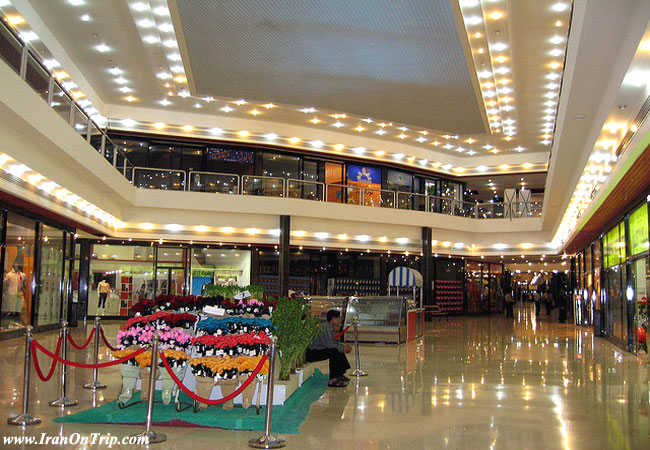
Kish is a trade free zone and many Iranians and foreigners come here to buy duty free cloths, electronic goods, cosmetic etc. There are many big, modern shopping centres, most of them in the east part of the island. Most shops are closed from 13.00 till around 17.00. Kish international malls try to satisfy every taste. Be prepared to find numerous faux American and European brands such as Gucci, Prada, Diesel, The Gap, Ikea, and Starbucks. These stores are cloned names only as the merchandise inside is not authentic. One exception is the 'Ikea' store, which is known for importing real Ikea merchandise such as ice-cube trays and dishes. A few of the malls are:
Paradise 1 International Mall
Paradise 2 International Mall
The Paniz International Mall
Zaytoon International Mall
Morvarid International Mall
Venus International Mall
Marjan International Mall
Arab bazaar
Kish trade center
and many more...
Working Hours
Most People in Kish Island work from 9:00 AM to 5:00 PM,including government employees. In addition the government employees have a Thursday half day, 9:00 AM to 1:00 PM.
Eat
Kish Island offers a wide select of restaurants which range from Persian to International restaurants.Here are some of the famous restaurants:
Shandiz Safdari. Best shishlik (lamb chop grilled) in Kish Island, accomoanied by Iranian Rice and Laban (Yoghurt) drink.
Boof Fast Food Restaurant. Kish's Answer to McDonalds.
Espadana Restaurant.
Papa Restaurant.
Hadee's. Best Pizza For Pizza Lovers.
Kish KFC. Kish Fried Chicken.
Asal Kish Restaurant.
Pars Khalij Buffet.
Salar
Kooh -e- Noor. World Class 5 Star Restaurant of Sadaf International Hotel. Nice Place With Theme of a Cave. 'Kooh -e- Noor' means Mountain of Light and is the name of a world famous diamond(Largest ever to be mined anywhere in the world)mined in Mugal period in India. Architect :Dr. Keyvan . Project Manager :Mr. Behzad Molk Araei
Pavion Restaurant.
Nagshe Jahan Restaurant.
Drink
Like other parts of Iran, alcoholic beverages are not allowed on the Island. The tea is light, good in taste and is kept at every home, shop and other social places.
'Cafe Aquarium' (ground floor of Pardis II Shopping Mall.) This popular hangout serves Starbucks coffee, Italian style sandwich, banana splits, and fresh juice to a young, hip crowd.
Sahndiz Safdari. Best shishlik in town, serves grilled lambchop, chicken, fish, eaten with Iranian rice and laban (yoghurt) drink, very popular. expensive. edit
Sleep
The accommodations on the island are a little expensive comparing to the mainland Iran, Kish Island has nice villas, hotels, and guest houses. Hotel reservations must be made through a travel agency in Tehran, which can be difficult if you are not Iranian and/or do not speak Farsi.
Get out
If you feel like going to another beautiful island, Qeshm is close by. You have the options of boat and plane. If you feel like going somewhere cultural and beautiful, the city of Bushehr is anticipating your arrival in the mainland.
More Information about Kish
1) Natural Geography
2) Historical Geography
3) Tourist Attractions
1) Natural Geography:
Geographic Location
Geographic location, Topography, and Climate
Kish island has a surface area of 91 square kilometers, with an outer boundary of 40kms, and a nearly elliptical shape. It is located in the Persian Gulf 19kms from mainland Iran. The Island is positioned along the 1359km long Iranian coastline north of the Persian Gulf, at the first quarter from the Hormuz entrance to the Gulf. Its longitudinal and latitudinal positions are 2632 and 53.58 degrees respectively. The Island is 15.45kms long from west coast to the east coast. (the distance between Mariam mogheyat-joghrafia.jpgComplex and Hoor field). Its maximum width extending from the southern shorelines to the northern shorelines is 7.5kms. (the distance between Gomrok Port and the lighthouse.) The island's surface is flat, lacking mountains or even high hills. Kish International Airport is built in the center on an elevated area 35-40 meters from the sea level. Its highest surface inclination extends from the airport to the shores near Shayan hotel.
Climate, Nature, and Geobotany
Kish, like the other Persian Gulf Islands, especially the islands in the Strait of Hormuz, is located on a narrow strip of tropical vegetation in the Northern Hemisphere, with the Persian plateau to the north and the Arabian Peninsula to the south. In addition to its special geographic and climatic attributes, Kish Island, like other nearby islands, such as Farrow, Hindorabi, Shatuar and Lavan and even Gheshm, is under the sway of the semi-equatorial climate dominating this band of vegetation.
The Weather
Since vital climates are influenced by the combined effects of rainfalls and humidity and are measured by the ratio of the size of annual rainfalls in millimeters to the degree of temperatures is less than 2 to 1. According to this measure, Kish's climate is considered to be a very dry semi equatorial climate. For an 8 year span of time, the median annual rainfall in Kish has been 145mm (54% in winter, 28% autumn and 14% in summer) and the annual temperature 26.6 Celsius. The relative atmospheric humidity in Kish makes it like a sea island except in cold seasons. The humidity is about 60% most of the year. In the months of October to April, Kish's weather is mild, ranging between 18 to 25 Celsius. The statistical data in the Kish free zone's archives show that the island's temperature varies form very hot to moderately hot, accompanied by relatively high humidity often interspersed by heavy rains of short durations in certain seasons. With the exception of some southeastern coastal areas and a few other islands in the Persian Gulf, Kish Island has the longest sunny hours in the region which is roughly 3100 hours a year. Based on climatological classification and general weather conditions and nearness to the Tropic of Cancer and exposure to high tropical pressure system and being in the midst of hot and shallow waters, the island tends to be hot and humid most of the year.
Rainfall
Rainfall in Kish usually begins in the months of November and February. The November rains are rather irregular and varied in intensity, but February rains tend to be relatively more stable with an annual average of 31mms . The rain season, however, may begin earlier in the month of October and in April; but on the whole the rain may last only a few days at a time.The major cause of scattered rains on Kish Island relates to the arrival of an air mass over the Persian Gulf. Rains in the Persian Gulf region are mainly due to the high pressures of southern humid air currents (Sudanese) and the low pressure rainfall.jpgsystems of the Mediterranean and the currents of humid air from the Indian Ocean. They are also affected by the ringing season. It rains during cold season, but not during the hot season. Kish Island is situated on a strip of tropical vegetation; it is natural that it has been occasionally affected by the seasonal currents from the Indian Ocean, especially in the month of July when these oceanic currents reach their peak. They occasionally cause scattered, swift summer showers of short durations. These summer showers are sometimes the amount of annual rainfalls. They often give rise to flooding. The ratio of annual rainfall to annual evaporation is indicative of the state of a climate. If the minimum evaporation rate is ten times the size of total rainfalls in a region (such as the Sahara or most of the central parts of Iran) that region's climate is said to be hot, arid and barren. However, despite the fact that the average annual rainfall in Kish is around 145mms and evaporation around 2700mms, i.e. 12.5 times the amount of rainfall, the island's location amidst the Persian Gulf's warm and shallow waters, where humidity is at the level of saturation (50-55 in march and 60 in July) the island has a marine climate.
Water Sources
Kish Island's past and present sources of water
Regarding the supply of water on the island, Jamal el-Din Abolfath Ya'ghoub al-Dameshghi, known as Ibn-e Mojaver (around 772 years ago) has given an account of the water in kish (in the Mostanasar's history which was dedicated to Mansour Mostansar, the Abbasi caliphate). His accounts include "there were many palm groves and a qanat aqueduct which passed abb.jpgthrough the Emir's garden. Natural springs and streams and qanats filled the water cisterns which were used for irrigation. It was possible to dig a hole by hand to reach underground water". This account is not in accord with the fact that the Kish average annual rainfall of 145mms will have to cover a surface area of 90 square kms, which amounts to 13,000,00 cubic meters, particularly if one is to calculate the amount of evaporation immediately after each rain and before the rain water is absorbed by the soil. The rain water seeping underground must have been indeed very meager in the past. However, when the island's population shifted seasonally between 1000-2000, the available supply of water was enough for the residents and, apparently, for the passing vessels and agriculture. The island's water distribution facilities, such as underground cisterns, ponds, and wells of different depths in the northern parts were adequate for the tree covered areas. In 1941, General Ali Razm'ara describes the island's water as coming out of the wells and tasting good. Passing vessels usually come to this island to take water. The depth of the island's wells varies from 5 to 10 meters and water can be taken out easily. He then goes on to introduce the island's better known wells in the residential areas:
1- The well named 'Mamzar" (or Momzar) in the township of 'Mashed" on the eastern part of the island. The land around the well was piled up like a dirt dam to direct the rain waters in the rain season into the well.
2- The well named "safa" in "Sajm" village north of the island.
3- The well named "Bala" between the villages of "Deh' and "Saghin" in the eastern part. Both villages used the water in that well.
What can be deduced from the past? Writing about the living conditions of the island, it was sparsely populated relative to its size, with a limited native population. The architecture lacked extended land manipulation, which could disturb the balanced ecosystem of the island. But, at present, large scale construction work and extensive scattered earth moving is taking place and asphalt and concrete has covered a large part of the island, preparing it for many large and small commercial, industrial and service structures. Indeed, much necessary or unnecessary land manipulation in all parts of the island, as well as a growing number of residents and tourists is putting the island's environment and its natural capacity on the verge of becoming unbalanced and highly vulnerable. This can be prevented if enough attention and care is paid to it. Unfortunately, it is always easy to destroy nature but difficult, if at all possible, to repair. This is a problem that renders sustainable development difficult. The island's drinkable tap water comes from an assortment of modern water desalinization plants. But the return of waste water and refuse by means of sewers into the sea has become an environmental problem. A price has to be paid for development, civilized living and comport. Yet the rational mind says that, firstly, exploiting the environment should not exceed its natural abilities to renew itself. Secondly, those techniques and methods should be used which maximize environmental decomposition. Since development is inevitable, and we can not forego socio-economic and cultural progress, we must make rational use of the environment.
Geography
Geographic and climatic characteristics on Kish Island
Kish Island is a small dry land sitting like a ship in the warm and shallow waters of the Persian Gulf. Its microclimate is strongly dominated by events in the vast context of the surrounding sea, limiting the range of temperature changes throughout the year. Humidity is mostly at a very high level (relative humidity is 50-60 per cent) and the average daily temperature fluctuations is less than 9-10 degrees throughout the year. Temeprature never reaches freezing point. The average humidity per kilogram of hot dry air (based on statistical tables for the Kish Free Zone) is 15 grams in the month of January and 25 grams per kilogram in the dry and hot month of July. From the month of October to April, Kish has a pleasant warm weather and the environmental conditions are agreeable. From May to October, the weather turns hot and humid. The average daily temperature in the months of May and October are similar. Since the sea water is still relatively cold in May, it has a relatively low humidity level. During this time, the weather is somewhat dry, accompanied by a mild, cool wind, giving Kish a pleasant spring season on the whole. The difference between the highest and lowest temperature levels in Kish is around 16 degrees Centigrade. The month of October shows the lowest level of evaporation, with a 12 per cent fluctuation, and is the island's coolest and driest month of the year. The month of August, with the highest level of evaporation, fluctuating 28 per cent, is the hottest month on the island. High evaporation levels in this month often cause seasonal showers related to the humid air currents coming from the Indian Ocean. In August, occasional flush rains and flooding often wash the soil and moisture in the soil quickly evaporates due to intense heat. Yet, these seasonal rains falling from the sky are a blessing and should be fully utilized and husbanded by appropriate canalization and construction of dams of varied sizes. Fortunately, on islands like Qeshm, the tip of the island's geologic makeup is such that, despite being situated over a sally dome, contrary to other islands like Qeshm, the tip of the dome is not high enough to contaminate the surface rain waters seeping into the lower grounds. As a result, the Kish underground water is not salty. It is, therefore, essential to make the most of the rainfalls. (Saline soil on the island, relative to the total area, is scarce).
Atmospheric System
The atmospheric systems, currents and temperature
The direction of air currents over the island is well recognized. The dominant winds come from the west and southwest and their direction usually change with the angle of the sun and seasonal changes. In hot days, the island experiences southerly and sometimes southwesterly winds. In the fall and winter, the direction of the winds is northwesterly and westerly. Occasionally, northerly and easterly winds occur. Among the regional winds, mention should be made of north wind or Naashi wind, "Nashtee" wind, Sharji wind, Sharghi wind and Soheil wind which the natives call "bad- e saheli". To study the atmospheric currents, especially the horizontal ones, one has to consider the island's position between the two vast dry dama.jpgplateaus of Iran and Saudi Arabia. In a hot, low pressure system – either two centers, one over Pakistan and one over the Persian Gulf, over which lay the high pressure of the tropical periphery – is formed. The high pressure of tropical periphery over the low pressure clears the air and causes much of the low pressure clears the air and causes much of the sun rays to reach the surface of the island. It increases the effects of the low pressure underneath and causes a kind of heat reversal. Although this heat reversal has no bearing on the rain patterns of the island, but it affects the region's weather. This is because the low pressure system – the Persian Gulf low pressure system – sucks in the air from the Iraqi highlands and the Saudi plains, causing mild and dry winds called "Bad-e Shomal" being blown from Iraq, the plains of Khuzestan, and the Zagros mountains. Of course, southerly and southwesterly currents of hot and arid air coming form the Saudi Arabian Peninsula are drawn into Iran's low pressure system center. The result is that this dry air current over the Persian Gulf is absorbed in to the humid air and, through that, is transformed into hot and humid air which, due to the existence of a low lying reversal layer in the region, prevents the hot air from ascending higher. It is kept at a low level, creating the extra humidity on the island. The cycles of the Iranian airspace from the west push the opposite air mass from the gulf region. The passage of this air mass, which picks up moisture over the Persian Gulf, sometimes causes rains over the island and the eastern parts of the country.
Natural History
Formation and geology of the island
Some 200 million years ago, as a consequence of continents moving and exerting enormous pressure on each other and causing high land creases and mountains, the Arabian Peninsula, then part of the African continent, moved northward (around 65 million years ago), got detached from it and was then attached to the Asian continent. The pressure resulting from this southwesterly movement on Iran produced the high land creases in the Iranian plateau known as zamin.jpgthe Zagros mountain ranges. These mountain ranges were formed along a northwest – southeast direction which is perpendicular to the line of the continental pressure. The highest elevation in the Zagros range is the "Dena" peak in BoyerAhmad and Kohkiluyeh province, 4409m high. The height of the Zagros Mountains gradually decreases as they reach the Persian Gulf, disappearing as submerged land creases in the Gulf. Kish and other islands of the Persian Gulf are the anticline folds related to the Zagros structures. The Hendorabi and Lavan islands to the northwest and southeast of Kish Island constitute other Zagros – related anticlinal folds close to it. Following the formation of these islands, the rise of the sea water, the relatively hot climate of the time, the shallowness of water and intense sunlight and other suitable ecological conditions, created a favorable environment for the growth of corals, shellfish and other aquatic life on the surface of the submerged islands. As a result of such marine life activities, a mass of compressed calcified coral reefs has been formed over the islands, which are the
remains of their calcareous shells.
Island Formation
Formation and Geology of the island
Some 200 million years ago, as a consequence of continents moving and exerting enormous pressure on each other and causing high land creases and mountains, the Arabian peninsula then part of the African continent moved northward (around 65 million years ago), got detached from it and was then attached to the Asian continent. The pressure resulting from this southwesterly movement on Iran produced the high land creases in the Iranian plateau k known as the Zagros mountain ranges. These mountain ranges were formed along a northwest – Southeast direction which is perpendicular to the line of the continental pressure. The highest elevation in the zagros r ange is the 4409 m high "Dena" peak in Boyer Ahmad and Kohkiluyeh province. The height of the Zagros Mountains is gradually decreased as they reach the Persi Gulf, disappearing as submerged land creases in the gulf. Kish and other islands at the Persian Gulf are the anticline folds related to the zagros structures. The Hendorabi and Lavan island to the northwest and southeast of Kish island constitute other Zagros – related anticlinal folds close to it. Following the formation of these islands, the rise of the sea Water The relatively hot climate of the time, shallowness of the water and intense sun light and other suitable ecological conditions, created a favorable environment for the growth of corals, shellfish and other aquatic animals on the surface of the submerged islands. As result such marine life activities, a mass of compressed calcified coral reefs has been forned over the islands, which are the remains of their calcareous shells.
Soil formation
As indicated above, Kish Island has been constantly exposed to environmental changes after its formation for millions of years - especially environmental changes and the rise and fall of the water levels. These occurred during glacial, and between glacial periods which lasted for a long time. During the glacial periods, when the temperatures fell and large sections of the land were covered by ice, and the oceans and the open seas in the polar region and in the neighboring areas were turned into large masses of ice, the water levels in the other oceans and open seas went down, retreating from the surrounding lands. Thekhak.jpg Persian Gulf was obviously, affected by these changes and, at times, completely dried up, its bed appearing like a wide green valley. The present day "Atvand' river flowed through this valley into the sea of Oman. Kish Island appeared on the northern bank like a huge hill-like elevation, 50 meters high and covered with vegetation and harboring many living organisms, including, perhaps, human beings. During periods which sometimes lasted tens, or even hundreds of thousands of years, the disintergated tissues of plants and living organisms accumulated on the top. Between glacial periods, when the weather was warm and the ice melted, sea water levels resided again. The Fars valley (the bed of the Persian Gulf) was again raised, inundated by the open sea, and the Kish elevation appearing as an island was submerged. It was now the turn of the corals, shellfish and other aquatic life to flourish on the surface of the island. During this period, the calcified residuals of reefs and shellfish, subjected to blows by winds and storms, developed into shell- like layers of sedimentation and spread over the previous layer which was rooted in the dry land. Eleven thousand years have now passed since the last glacial period when Kish Island emerged from the sea. Constant heat and heavy precipitations pounding the island's surface has covered it with sedimentation. Plants have grown on them and living organisms have found their habitat on them. The remains of these plants and animals together form a coral layer which was formed when the island remained submerged.
Top Soil
The development and value of Kish Island top soil
It may appear that the unutilized top soil in the island's periphery, having a thickness often not more than a few centimeters, is worthless. However, when we reflect on the time it takes for one centimeter of top soil to be formed, which is between 800 to 1200 years, we will appreciate its true value. During the long periods it takes for the soil to form firm it up. This quality helps the soil to gradually come to life, serving as a base for the growth of plants and as a habitat for land creatures. A consideration of the nature's prolonged endeavor to make top soil should make every thoughtful and responsible person duty-bound to preserve it. It is, therefore, necessary that, during every development work, particularly when using heavy duty machinery (such as bulldozers, graders, etc.) care be taken not to damage the soil more than it is needed or essential. The unnecessary moving of the earth which is taking place throughout the island, and other similar destructions of the land, can be detrimental to the island's sustainable development and the solving of its environmental problems. It is essential that, like khak2.jpgmany other places in the world, not to render the land barren unsuitable for plant growth. In some countries, they have passed laws that, even in hunting areas, the width of tyres or the weight of the vehicles must not go beyond certain limits.
The combination and spread of the soil: The earth in the center of the island's elevated part is 35 to 40 m high. The building of the airport at the center of the island necessitated leveling part of the land to make runways and other structures needed to operate an airport. Also, the digging up and transfer of sand from this area for construction purposes has destroyed the thin, soft, gluey and live ancient top soil. As a result, the thin top soil which is now manually used in some parts of the island is not fertile, lacking the required qualities and the gluey characteristics or any of the decayed materials found in the old soil. Of course, the top soil around the airport, protected by a fence is still virgin and undisturbed.
The soil in the west of the island: This area, which covers nearly half of the island, inclines slightly towards the sea and erosion by rain has been negligible here. The top soil is thick, reaching two centimeters or more. Nearly half of the washed soil from the central parts of the island has spread over this area.
The soil in the east, northeast and southeast of the island: These parts of the island are flatter than parts described previously. The soil of the northeastern shore strip relative to the southeastern shore is in-between the central and western parts.
The soil in the north of the island: The surface of this part is relatively thick, soft and harbors many shallow pits and ditches.
The soil in the center of the island: This is a mixture of clay, silica, sand and, more or less, remains of decayed animal tissues (natural fertilizer) residuals (animal manure) and plants (humus). The soil in the island's central parts is mostly coral. From the center to the shores is mostly covered by a mixture of clay and decayed materials. The surface of the eastern and southeastern strips is covered by almost uniformly white and sparking shores, which are exposed to lashes from the sea waves, and are covered by sand and porous rock pebbles.
Vegetation
A General View of the Vegetation on Kish Island
The geographic position of Kish Island in the southern coastline of Iran lies in a narrow strip of a dry and tropical land. The island's special geographic and climatic conditions in the warm and shallow sea waters near Hormoz strait has kept the vegetation on the island in poor conditions. Meager annual rainfall and evaporation which is many times more than the rainfall, as well as high temperature during most of the year, have created an arid, semi-desert an desert-like climate on the island. A lack of topographical complications, a thin top soil over the island's hard and extended coral reef base, aridity and heat are the main variables affecting the pattern of poor vegetation on the island.
The island's vegetation is made up of two groups, the annual and perennial gramineous plants and semi-wooden and wooden plants. The fall of the island's plants begins at the start of the dry summer heat.
Gramineous plants usually appear gradually from mid- October, giving the island's sun-seared, grayish land a green look.
By the end of April these gramineous plants begin to dry up, leaving behind a yellow and grayish appearance throughout the island.
Against this background, patches of green and silver- green perennials often come to view during summer.
Some of the annual plants of the island consist of different kinds of Chlorophytum, Calendula Persica, Germander plant, Matthiola, Cyclamen, Alfalfa, Fenugreeks, Euphorbia, Pelargonium, Dutra, Heliotropium, Sorrel, Plantago, etc.
Perennials include many kinds of Chlorophytm, ivy, Chenopodium, Umbelliferae(the Apiaceae).
Astragalus, Japanese Sedge plants, Abutilons, Mellitus officinalis, Papilionaceae, Halophytes, etc.
Short and frutescent shrubs of the island consist of Lycium chinesis, Ochradenus, Ephedra sinica, Indigo plant, some kinds of Malvaceae, some kinds of Chenopodium album, Halophytes, Tamarix hispida, etc.
The natural and native trees of the island include Prosopis, Ziziphus Spina-christ, quite tall Tamarix hispidas, Ficus bengalens which have been planted in the past and have assumed a native plant status, Acacia nilotica and some other Acacia species which have been planted alongside Prosopis juliflora and Eucalyptus, Arecaceae, Coco, Terminalia catapa, Cordia myxa, and some other trees.
Perennial herbaceous plants sheltered by the shade of palms and other trees in the garden that are watered down, and the soil which is damp enough, last to the end of the vegetation season.
These plants are found in the shades and spread widely in palm groves.
In the summer when the heat and aridity is extreme especially in drought, perennial shrubbery, as well as the trees lose some of their green foliage and look dried up and grayish. Around mid-December, following the usual rains of this month, green buds begin to grow in the previous year's dry, lower parts of the shrubbery, changing them into a luxuriant growth of dry and green branches. The growth of the annual plants in many places gives the island a spring time appearance for a while. In the years with scant rainfalls, and there are many of them, giving rise to dryness and extreme heat the tips of the perennial plants and even the shrubs and trees, lack sufficient budding and appear dry and since these perennial herbaceous plants and semi- wooden shrubs make up the island's vegetation, most of the year it has a grayish look.
Phytogeography
Kish Island's Phytogeography
Much of Persia belongs to Holarctic Kingdom. Persian Gulf coastal areas including Kish Island are situated in Paleotropical Kingdom. The boundary between the two kingdoms of Holarctic and Paleropical is extended towards south of Iran. Among the divisions that have been done so far on the Iranian geopgraphical areas, there is almost no general consensus on the regional boundaries and the board outlines of vegetation growth.
In Iran only Ilam, Poshtkuh and Khuzestan are situated in Sahara-Arabia region. From the Paleotropical Kingdom only its Sudanese region, namely Nubo-Sindian desert is located in Iran. According to Zohari, the north range of Nubo-Sindian desert in Iran is the northern region for the growth of Ziziphus and various species of Acacia which are sensitive to cold weather and their distribution range is confined to the Persian Gulf area that are capable of penetrating other regions of vegetation.
The special Nubo-Sindian plants are xerophyles and thermophile. While they can bear strong summer heat and very high humanity, they also need mild winter weather. The Nubo-sindian vegetation found on Kish Island consists of semi-desert shrubs and trees.
Farming
Traditional farming and animal husbandry in Kish
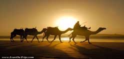
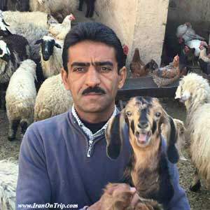
Farming and animal husbandry in Kish is a thing of the past. What can be seen of it today are abandoned farming sites as an indicative of the very small size of its population at the time. Remnants of relatively long draining canals and floodways to carry rain water can also be seen. Water wells in the western parts of the island, are remains of the past agricultural activities of the island. While the island's present characteristics have changed drastically in comparison with the past and the construction of many hotels and shopping centers, quarters for commercial and recreational activities, as well as residential areas have taxed the island's environmental capacities, we can, nevertheless, still see the island camels. The livestock are kept to provide meat and dairy products for the residents. But, they feed voraciously on the island's available plants and needs to be solved promptly. The grazing of the livestock, especially by the goats in dryer seasons, causes heavy damage to the island's vegetation and puts further constraints on the livelihood of the wild gazelles let free on the island. This is also a threat to the health of the island's environment. One of the very interesting measures taken by KFZO has been the creation of exclusive reserves for the wildlife, where watering holes have been provided for the gazelles by means of wind-powered pumping. Seeing these wind-powered pumps reminds one of reconciliation between man and nature. The number of goats now grazing on the island is beyond what it can bear. The goat population must be reduced to prevent damage to the island's environment. There are also large numbers of goats on Hendorabi Island, which is facing a dry season a dry season and is likely to have its vegetation damaged by the goats. The island's natives have a gentle disposition and are well-behaved and, like al other southerners who endure sunshine, have a dark complexion. They subsist on minimal agriculture, fishing and occasional camel raising to attract commerce, and some engage in shop-keeping and general services. Excepting the gazelles, which are free to roam the island, all other livestock should be kept confined to special corrals where feedstuffs are brought in from outside the island.
2) Historical Geography
History Perspective
Kish in the perspective of History
Some references have already been made to the islands origin and natural history. But not much reliable and written material is found concerning its ancient social history. There must have certainly been left somewhere written account or other evidence about this island which might have been destroyed by foreign enemies who invaded the island. To be sure, Kish must have experienced who invaded the island. To be sure, Kish must have experienced periods of hardship and ruination duringHarireh-Ancient-City2.jpg the natural tribulation of its long history. It must have been invaded often and rule by alien forces. But Kish Island in the Persian Gulf has remaind, like other island such as Qeshm and Hormuz is an integral part of the safety reasons, not far from the coastlines, Kish was frequently used as a port of call by the ancient mariners who got drinking water and other necessities from the islanders. Kish island's strategic position served as a way station and link for the ancient Assyrian and Elamite civilization when their primitive sailboats navigated from Susa through Karoun river into the Persian Gulf and along the southern coastline passing kish, Qeshm and Hormoz islands.Kish was, in particular, economically and politically linked with the civilization of the Medes and Persian and Arian people when they were in the height of their power. And when this civilization vanished, the Kish Island's advantageous position was lost and for a period was subjected to turmoil and tyrannical of the local potentates and other venders. With the establishment of the Achaemenian emirs that reached the far concerns of the civilized world and contributed much to human advancemece he Persian Gulf was profoundly affected. In the shadow of the empire, the islands in the Gulf became prosperous and navigations in the gukf was expanded and better vessels were used to carry passengers and goods. Navigational signs, including lighthouses, were set up to facilities navigation in the gulf. Because of its proximity to the mainland Persia, Kish Island resumed its advantageous position and enjoyed many benefits until the end of the Ashkanid (the Parthians) and Sassanid empires.
Advent of Islam
Kish at the advent of Islam and afterward
It was 23 years after the Hegira when Kish finally surrounded to Arabs. All the island in the Persian Gulf, including Kish Island, was situated in the sea routes of the Arabs trying to invade Fars and Kerman province in the mainland Persia. It was natural that Kish would be a target of invasion. Unfortunately, the governors appointed by them to other island were often tyrannical. The first governor sent to Kish by the Arabs was a man from the name of this first Islamic ruler from the Gheis which later corrupted to Kish. This island, however, appears by different names in the writings of foreign historians before the advent of Islam. In the 2 nd century A.D.Kish, in the writing of historians, is called in Greek, "Kaminane", "Arianus" or "Arian" or "khen". In the texts of the Iranian historians Kish is referred to as "Kian", "Kish", "Gis" or "Qheis" and some texts it is erroneously" called "Ghesh". During the first half of the Hegira century when Iranians were rebelling against the Arab invaders and were fighting them in the southern and western towns and cities in Iran, Kish was caught I the middle of these rebllius events and periodic of crises and all the past commercial activities in the island, and with it all propensity came to a halt. During Safarin period, especially at the time of the AL-e-Buyeh rule, (the first Iranian government, following the Arab domination,) when they ruled over a vast domain of some e2.5 m.sqk and when the Abbassi caliphate in Beghdad was under their influence and also during the rule of the Seljukian, which brought to the mainland a period of prospentiy cultural revival and commercial activities, especially marine commerce, Kish Iland again regained its traditional activities and rightful status. During the Atabekan of Fars and the Seljuki Malekshan period in the 6th and 7th Hegira centuries when their political power was at its peak in southern province of Fars, Kerman and the Persian Gulf,Kish status was revived, thanks tit h perspicacity of their Iranian viziers. Even after the Mongol invasion of Iran, the island managed to thrive with its normal commercial activities.
Governments
Kish at the time of IIkhanian, the Safavid and subsequent governments
During the Safavid period, which was a time of commerce with the west and Europeans ambassadors and envoys were dispatched to Persia, Kish continued to thrive. However, this was also a time when colonialism appeared on the international scene and colonial powers began to expand their influence around the world. Kish was only seen as an important base for international trading. Thus it became a tempting target and also a point of reveries for the colonialists.Unfortunately, weak central governments in Iran and self–seeking tyrannical rulers who were often more inclined to pursue their own private interests, rather than safeguard the country's higher interests, played into the hands of the European colonialists who had superior naval power. Kish and other islands in the Persian Gulf were thus colonized. Kish went through harsh periods of ups and downs during this early phase of colonialism before it was finally liberated. During the reign of Shah Abbas of the Safavid dynasty, and Nader Shah of Afshar and Karim Khan of Zand, Kish was freed several times from alien domination. Portuguese colonialists were delivered a heavy blow by the hands of Shah Abbas' famous commander, Imam Gholi Khan, and others who forced them to leave the Persian Gulf Island.
Since Ghajar Period
Kish under the Ghajar dynasty
The Ghajar dynasty was established seven years after the death of Karim Khan of Zand when, due to widespread rebellions and insurrections by the claimants to the throne, the Persian Gulf was at its worst socio-economic and social situation and its islands, including Kish, suffered much from this instability. The British, who themselves had a hand in bringing about the chaotic situation in Iran, were constantly adding fire to the fuel to achieve their objectives. First, they occupied Qeshm island at the entrance to the Persian Gulf, making it into a naval base from where they encroached on other islands. The transgressions of the Portuguese, British, pirates, sheikhdoms, and the Sultan of Muscat, provoked mainly by the British, destabilized the Persian Gulf. This instability was used by the British in 1869 to force the Sheikh of Bahrain (who was a protégé of Iran) to become their protégé. This meant Bahrain Island was no longer part of Iran. Under these circumstances, economic chaos, and political instability, Kish island, this pride of the Persian Gulf with all its legendary fame and reputed wealth was sold at the time of the Iranian constitutional revelation in 1906 for a meager 25 000 Toumans by Mirza Ebrahim Khan Ghavam ol-Dowleh to Mohammad Reza Khan Basteki.
Kish under the Pahlavi dynasty
The unfortunate circumstances of Kish Island at the time of Reza Shah were more or less similar to the Ghajar era. For a long time the British, ruled the waterways and millennia-old Iranian island in the Persian Gulf under the pretext of safeguarding its security according to an old imposed treaty, especially in order to keep the oil rich lands of Iran. The presence of foreigners and their imposed hardships gradually forced the population of Iranian islands to leave, leaving them looking like ruined ghost towns. Commerce and trade came to a standstill. Some were turned into places for political exiles, wantons and hardened criminals. Despite its past position, and the comings of goings of traders and its flourishing commerce, ruling over all other Persian Gulf islands at the time of the Atabakan of Fars, and even used by them as the exchequer where the Fars treasury was kept, Kish Island, once the pride of the Persian Gulf, was reduced to dire poverty and ruin; it became a sorrowful place, with a few old tress and hectares of abandoned farmland and a scant population of women and children, and the old. This state of affairs lasted from 1941 to 1968, with negligible changes.
The winds of change
The year 1968 witnessed administrative reforms and some new activities on the island as it was recommended by American advisors that the island be used as a "free zone for tourism". Thus, in 1970, Kish was formally selected as an international center for free tourism and commerce and its geographic position and natural resources were put to full use. In 1972, the island was renamed "Kish Development Organization" with a capital of one billion (80 percent of which was paid by the "Savak", the former security organization and 20 per cent by Omran Bank backed up by the Central Bank of Iran). Building operations for the Kish Development Organization was launched in 1973 in the village of "Masheh" northeast of the island. Simultaneously, construction of an international airport, large enough to accommodate the largest of jet aircrafts, began in the center of the island, bearing toward the east, and the highest point of the island. In the year 1977, Kish Island's international center for tourism and commerce was officially opened and the construction of the relatively extensive service structures was nearly completed. In 1979, a year after the Islamic Revolution, and the overthrow of monarchy, "Kish Development Organization" was put under the jurisdiction of the Ministry of Culture and Islamic Guidance with the title "Organization for Iran and World Tourism Centers". However, five months later, the Council of the Revolution called it the Islamic Republic's First Free Zone of commerce. In a cabinet decree in 1982, "Kish Development Organization" was brought under the control of the Minister of Sate for executive affairs and, in 1986, the Council of Revolution inaugurated the Kish facilities for free shopping and sightseeing. The year 1986 is in fact Kish Island's year of revival as a free zone. From this time on, the rush of tourists, and relentless expansions on the island began, including adding various commercial structures, bazaars, expanding piers and airport facilities, building new hotels, with emphasis on import-export operations, building new recreational centers and town squares, roads, and green spaces commensurate with the needs of the growing population and increased tourism. The development of the island has been kept up by careful planning to make Kish distinctive among the country's other free zones. In the year 2000, when the study of the island's vegetation and flora and its phytosociology began to prepare a map and book similarly entitled "Kish, Flora and Vegetation", it was realised that major portions of the island's top soil was under the impact of relentless construction. These building activities go on day and night, rendering the island's life-giving top soil barren and unproductive. In order to compensate for the island's natural capacity, measures have been taken to create green spaces and beautiful landscaping in two parts of the island, using plant species better suited to the environment. These and other environmental protective measures should not, of course, be underestimated.
Historian Accounts
Kish in travel books and the historian's accounts
Kish has always been described by historians as a green island with attractive surrounding and pleasant weather throughout the year. All these historians have had reference to the cultivation of cereals, beans, fruit tress, especially dates, in the island. It is also often said that "Kish is situated along the path of vessel carrying valuable cargos to the oversea lands in the equatorial and tropical regions. These vessels would stop at the island to take in drinking water and exchange goods with the native merchants. This kind of transaction made it possible for the well-to-do Kish merchants to help develop their island by creating gardens and palm groves and other civic structures that made life Pleasant for the residents and visitors. They persuaded the ship captains and foreign trades to bring in tropical plat seeds and saplings from overseas to the island to provide a pleasant, resting place for merchants who were tired of sea travel and the heat of the Persian Gulf. Thus trading and travel flourished in the island and this is the weiw of Kish as reflected in the writing of the historians and travelers.
3) Tourist Attractions
Kish The Coral Island
Kish Beaches
The coral beaches of Kish sparkle in the sunlight. This is something, which the sandy beaches of many jazebe1.jpgresort areas around the world do not offer. The seawater near the beach is crystal clear and one can see the bottom of the sea up to a far distance. This is, of course, due to the corals around the island, which purify the water.Relative to its area, Kish has one of the longest beach stretches. Unlike the crowded beaches elsewhere, the beach here is a relaxing and peaceful place. The fish and other marine life in the coastal waters of Kish are very unique. Visitors loose track of time when watching these species which are easily visible. At the same time, the best quality edible fish is caught here. The coastal waters of Kish are among the safest in the world. There are no sharks and swimming is totally safe. Tourists can use this beach and enjoy the sun and water all year round.
Harireh
The Ancient Town of Harireh
The ruins of the ancient city of Harireh measure around 120 hectares. This vast area surface tells the tale that a large and prosperous city once existed in this region with a thriving population. What remains of it today is a volume of urban architecture, but rarely will an arch, cover, or ceiling be seen intact, except for a few instances where arched stone ceilings have remained unharmed from the detriments of destruction. The Port of ancient Harireh was a concrete, well-knit city with an extrovert architecture. Here, there are no signs of an harereh.jpgintrovert, self-defending architecture which can be seen in other historic cities in Iran. Choosing this part of the island to build a city was a most natural and logical choice. Its high cliffs are over ten metres above sea level, with three capes acting as natural harbours, and a shore relatively calmer than other coastlines along the island, all in all helping to shape the city in its northern coast. To date, three separate archaeological digs have been carried out in the remains of the ancient city of Harireh.The aristocratic house: the aristocratic house is a reminder of old extended family homes inside the Iranian plateau and in cities such as Yazd, Isfahan, and Kashan. It is considered a model of extended family dwellings alongside the Persian Gulf. Apart from the expanse of the house and its varied spaces, star-shaped tiles have been found here which are similar to those ornating the important buildings of the Ilkhanate Iran, such as Takht-e Soleiman and Soltanieh. This find, which is certainly importand to the island, indicates that the building belonged to one of the rich inhabitants of Kish.The industrial section: This section is built exactly next to the sea and has an unknown style of architecture and spaces. The collection of lateral underground canals and numerous wells in the nooks and crannies form a unique and interesting complex, the function of which is still unknown. But, it seems to be directly connected to fishing activities (fish, pearls, and corals) and was built for easier access to the sea. It can also be presumed that these corridors were hidden passageways the inhabitants of the city could use in emergencies during times of attack and invasion. Public baths: This complex is comprised of a bath with numerous courtyards, and 500 square metres of fencing. The changing room, hot chamber, and furnace are situated in the south of the said section and are separated with an indoor corridor. Two small and large pools in the south of the hot chamber form the last section of the building.Archaeologists believe these baths, which may be the oldest of their kind in Iran discovered and recognised in archaeological digs, have two separated eras – Ilkhanate and Timurid. Considering the limited capacity of the baths, and the outside wall stretching to the aristocratic house, which is situated in the southeast of the baths on top a tall hill, it seems these were private baths belonging to the owner of the house.
Traditional water reservoir
One of the traditional methods of reserving water on Kish Island in ancient times was construction of water reservoirs.
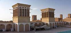
A Twin Water Reservoir with five wind catchers in the style of Yazd city architecture was built within the boundary of Harireh Ancient City near The Aged Banyan (Lour) Tree Park in 1993 for collecting rainwater where an ancient water reservoir was located.
This traditional water reservoir lost its main function due to the construction works in Kish which resulted in destruction of rainwater paths.
The unique architecture of this building reminds us of the old days. This attraction is very impressive and worth visiting for locals and foreign tourists.
Greek Ship
.jpg)
The Mysterious Greek Ship on the Beautiful Coral Island of Kish
In the west of the island, a massive ship has landed in the azure waters on the shores of Kish, which is known as the Greek Ship. On a hot summer's day, Kish natives saw a massive ship which had run aground near Baqou village with great astonishment. With the passing of years, the reason for the ship running aground remains behind a haze of obscurity. TheGreeceship.jpg ship was built by the William Hamilton Company in 1943, weighing 7061 tonnes and measuring 136 metres in length in Glasgow – Scotland. On July 26th, 1966, when returning to Greece form Iran, the ship ran aground at latitude 20º 26' N and longitude 54º 53' E. The Dutch tugboat, Orinoko, spent 80 days in vain trying to pull the ship out. Many failed attempts were made to free it, but the passengers were finally forced to abandon ship, because it was not financially feasible to move it. Information obtained from Lloyds of London insurance company show that the ship flew a Greek flag and was called Kolaof at the time. The ship's first name was "The Emperor's Horn", then "Naturalist", and in the years 1959 to one year before its final anchorage, it was owned by the Iranian ship company and was called "Cyrus Fars" and "Hamedan". Watching the sun set slowly behind the Greek Ship in the azure waters of the Persian Gulf is an unforgettable and lasting memory.
Recreational Pier
Grand Recreational Pier
Kish Grand Recreational Pier was built with steel piling and wooden decks with four side-deck spaces by Iranian experts. This pier is 437 meters long, 18 meters wide and 10 thousand square meters in area. Its construction did not damage the marine habitat. Tourists can enjoy the natural sights from this pier while watching the colorful fish species of Kish coral beaches. The first phase of Kish Grand Recreational Pier was constructed within a short period of 20 months and inaugurated on the 27th of July 2006.
Mosques
Kish Mosques
Kish has seven mosques. The Amir mosque, Khatam -Al-Anbia mosque and Noor mosque are some of the biggest mosques of Kish. Amir mosque is one of the ancient monuments of Kish which has been maintained beautifully by the Cultural Heritage Organization, by preserving the native architectural elements. They have tried to maintain this mosque situated at the back of Kish Free Zone Organization building in the early 1990s. The Khatam- Al- Anbia mosque is one of the magnificent religious monuments on the east part of the beach. Its high minarets give a very beautiful and spectacular view from the beach. This mosque is situated in Safeyn district and Kish Friday prayers are held there. Noor mosque is one of the biggest mosques attended by Kish natives, with a very special architecture and Friday and Sunni prayers are held in this mosque.
The Famous Aged Banyan Tree
The Green Tree Complex
At the end of the longest ancient alluvial path in Kish, surface waters run into the north of the island, to a valley known as the Portuguese Valley, making it a particularly green area. The Green Tree Complex is built around one of the island's oldest lure trees. The greenery of the enclosure, the buildings, wooden parapets and pavements bring to mind the northern parts of the country. But, one of the factors attracting tourists to this area is the legendary awe of the Green Tree. This is the island'sderakhtesabz.jpg oldest lure tree, and has a life of probably 500-600 years. Thread or material can be seen knotted on the tree branches, making it appear holy at first sight. Some people believe this is an auspicious tree, and so tie pieces of material to it to make their wishes come true. "The Green Tree Complex", with its beautiful alcoves and numerous barbecue areas has been renovated for the visitors to rest and visit free of charge. The pavements lit with lanterns among the evergreen spaces ornate with colourful bourgainvillia flowers, all lure you toward the main attraction of the complex. A prayer room, seasonal restaurant, buffet and lavatories are also available in this complex. The Green Tree Complex is adjacent to two important tourist attractions in Kish and has two entrances. One of them is a common door with the "Harireh ancient city", and the other is next to the "Traditional water reservoir". Both places are within walking distance of the Green Tree Complex.
Dolphinarium
Dolphin Park Complex
In a big beautiful garden of 70 hectares, where beautiful bougainvilleas are wrapped around palm trees, and green plants and colorful flowers present a different nature to the visitors, for the first time in the Middle East, sea mammals and penguins entertain the children and adults alike. More than 20 dolphins, sea lions, sea cats, sea boars, and white whales jump, cruise forward and backward, clap, snore and throw balls in the largest manmade pool on Kish Island. Sea mammals and penguins are dolfin.jpgnot the only amusements of Engineer Hossein Sabet’s Park & Resort Complex. The Bird Zoo, Cactus Garden, Orchid Garden, Silkworm House, Underwater Aquarium, and Erupting Volcano are other amusing sectors of the palm grove of the southeastern tip of Kish Island, which attract thousands daily. The visitors enjoy watching tens of different birds from all over the world, beautiful and rare cactuses and orchids, the metamorphosis of silkworms and cruising of fish in their natural environments during the daytime, and the erupting of an artificial volcano at nights.
Bird Garden
The Bird Garden is situated inside the Dolphin Park with more than 57 bird species, including Pelicans, Ostriches, Blue & Yellow Macaw, different kinds of Storks, Toco Toucans, Turacos, Swans, African Penguins and rare species like Marsh Crocodiles. This, undoubtedly, is one of the most unique animal centers in Iran. It is noteworthy to say that different kinds of species from the farthest parts of the world, from South America to Australia and from East Asia to Africa have been brought to this park.
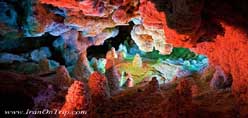
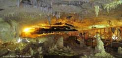
Kariz underground city
The aqueducts of Kish date back to 2500 years ago and provided the islanders' drinking water. Today, it has been transformed into an amazing underground city, with an area of 10 000 square metres. Its experienced advocates took on the painstaking design work and have tried to keep its historic fabric while providing new uses during its renovation. It is now called Kariz-e Kish. In its first phase, Kariz underground city will be functional with its handicrafts stands from Iran and the world, traditional and modern restaurants, amphitheatre, conference hall, and art galleries. The city is located 16 metres shahrezirzamini.jpgunder ground. Its ceilings are eight metres high and mostly covered by fossils, shells, and corals estimated to be 270 to570 million years old. Each one has been identified and they all have official IDs. Its advocates believe two of its characteristics will place it among world registered structures. Firstly, Kariz is situated in the heart of the only coral island in the world. Secondly, it is the only structure with a ceiling of natural shells and corals, for which there were only two ways to be sees– natural museums or scuba diving in free waters. And now, Kariz has opened up a new exceptional chapter for all nature lovers who are able to visit the largest coral collection directly. And finally, it must be said that the earth excavated from Kariz has much medicinal value and will have abundant use in "mud treatment". This and various other facilities, such as residential, shopping, and leisure centres in a land about 60 000 square metres will be built on Kariz grounds. The ground above Kariz will be transformed into a large park with two high hills. These hills are from the excavated grounds of Kariz and will turn into a unique view of Kish Island.
Aquarium
Aquatic life in the Persian Gulf is diverse. The clear waters along the beach give tourists an easy view of the variety of fish species, some of which are very interesting. You can even take a ride in a glass-bottom boat and see the fish that swim a little further away from the shore. The Kish aquarium is located within the Art Center displaying a variety of unique marine species of the Persian Gulf. If you do not scuba dive to get a first hand view of the natural habitat of the colorful fish, a visit to the aquarium will be an alternative. We recommend that all tourists, especially children and the youth take the time to visit the aquarium.
Kish Beaches
The coral beaches of Kish sparkle in the sunlight. This is something, which the sandy beaches of many jazebe1.jpgresort areas around the world do not offer. The seawater near the beach is crystal clear and one can see the bottom of the sea up to a far distance. This is, of course, due to the corals around the island, which purify the water.Relative to its area, Kish has one of the longest beach stretches. Unlike the crowded beaches elsewhere, the beach here is a relaxing and peaceful place. The fish and other marine life in the coastal waters of Kish are very unique. Visitors loose track of time when watching these species which are easily visible. At the same time, the best quality edible fish is caught here. The coastal waters of Kish are among the safest in the world. There are no sharks and swimming is totally safe. Tourists can use this beach and enjoy the sun and water all year round.
Kish Buggy Track
The 400 meter off-road buggy track offers buggy rides in two-seater off-road buggies on Kish Island. Recreational sport tours are also held for buggy riders to drive all the way to some tourist attractions such as The Aged Banyan Tree, Hoor Hut and Greek Ship with a professional guide in front on a 4 wheel ATV.
For further information, please dial +98 764 9312737
.....
.....
.....