.jpg)
Mamasani plain

30) Mamasani is made up of three large alluvial plains, known locally as Rustam Yek, Rustam Do and Dasht-i Nurabad. The region receives up to 600 mm of rainfall annually and is also watered by a large number of natural springs which allow double cropping. Each of the large alluvial plains has at least one prominent tell site, the largest being Tol-e Nurabad in the Dasht-i Nurabad, then Tappeh Sornah in Rustam Do, and Tol-e Spid in Rustam Yek.
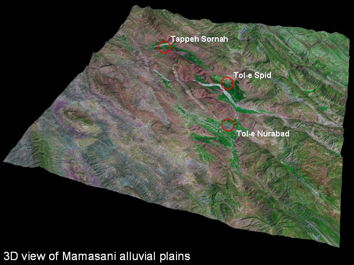
31) These three plains are joined by a series of passes. The Mamasani region is significant in that it lies not only on the main route between Susa and Anshan, but is the main junction with the route from the Persian Gulf port at Bushire. This suggests that the Mamasani region is likely to have been an important communication hub in the southern Zagros. In Mesopotamian cuneiform texts dating to the reign of the Ur III dynasty, there are references to a region that is called "Huhnur, the Key or Bolt to the Land of Anshan". Although it is not yet possible to be certain, it is possible that Mamasani was the location of Huhnur.
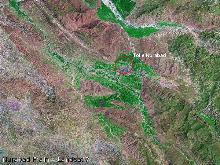
32) The site of Tol-e Nurabad is the largest mound site in Mamasani, being preserved to a height of c.23 m and an area of 9 hectares. It lies on the outskirts of the modern town of Nurabad, and recent soundings at the site by a collaborative ICAR/ICHTO and University of Sydney team have shown that the site was occupied from as early as the late 7th millennium BC up to the Sasanian period.
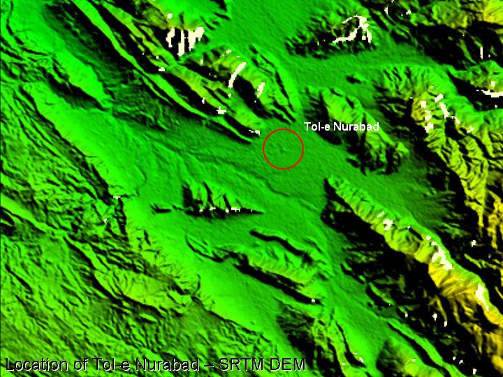
33) The mound at Nurabad is the most prominent feature visible on the SRTM digital image of the Dasht-i Nurabad.
.....
.....
.....