.jpg)
Oshtoran Kooh mountain
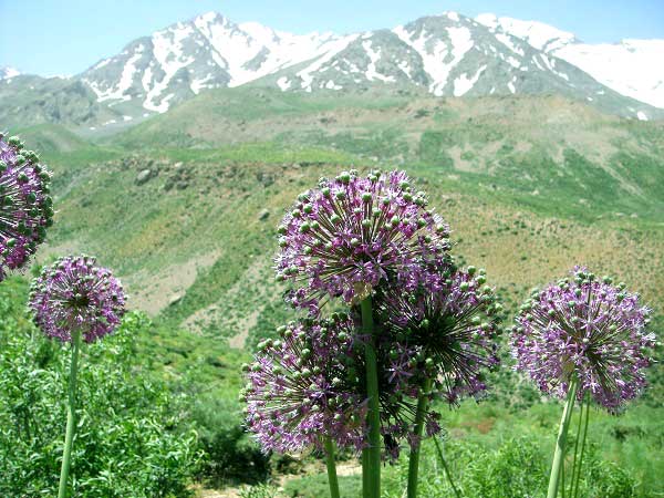
Oshtoran Kooh, Oshtoran-Kooh, Oshtoran Kouh, Oshtoran Kuh or Oshtoran Kouh is a massive sub range of Zagros located in Lorestan province about 500Km far from Tehran, about 18Km south-west to Azna city.Oshtoran Kooh is a long straight ridge line with the natural north-west to south-east orientation of Zagros range that expands to Chagha-Gorg area at south. Unlike the Alborz range that almost all of the ridges and sub ranges stick together at a high pass with a compact form seems like Zagros range ridge lines and sub ranges like Oshtoran kooh, Zard Kooh, Dena,... have a more discrete form, each being a massive block.
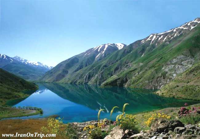
The highest point is a peak named San-Boran(4150m) or Oshtoran Kooh. Oshtoran Kooh has east and west faces that are totally walls, cliffs, rock routes and banded rock blocks which brings an impressive challenge, anyway the east face is easier and the route to San-Boran and nearby peaks is the easiest, the others peaks like Kool-e-Jennoo(3980m) are harder and need technical climbing knowledge. Another feature of the area that makes Oshtoran Kooh one of the favorites of Iranian mountain climbers is the beautiful south face with two lakes named Small Gahar and Big Gahar being great for camping.
The lakes, with a span of about 100 hectares, a length of 2500 meters, a width of 800 meters, and a depth of about 28 meters is situated 2400 meters above sea level.
There are more beautiful places for sightseeing around the Oshtoran Kooh, such as Negar valley(Dare-y-Negar), Bisheh Waterfall(Abshar Bisheh), Talezang waterfall(Abshar Talezang)... You can travel to these areas mostly by Tehran-Ahwaz train.
Oshtoran Kooh Peaks
The Oshtoran Kooh is almost a straight long north-west oriented to south-east ridge line with the following peaks on it:
north-west to south-east:
Peak Name Height (m)
Kabood Spring (Cheshmeh-e-Kabood) 3403m
Choloride 3866m
Golgol (Pazan-Par) 4100m
Golgahar 3950m
Kooleh-Lauyo 4020m
San-Boran (Oshtoran Kooh) 4150m
Chal-Boroon 4080m
Mirzaee 4080m
Fialestoon 3800m
Leger 3700m
Shah-Takht 3900m
Piareh 3850m
Soozany-e-MehrJamal 3800m
Malreh 3700m
Aznadar (Takht-e-Shah) 3750m
Homailoon or Kooleh-Jonoon or
Keft-e-Homayoun or Kool-e-Jennoo 3980m
Dareh-Daee 3400m
Kooh-e-Khalilabad 3400m
Objects
Glaciers
Each peak makes a curve line that vertically cuts the main Oshtoran Kooh ridge line, the pit spaces between these curves mostly on the north-east faces serve some small and large glaciers, these are the larger ones:
Kherseh-Dar glacier - north-west to San-Boran peak and under Golgol peak
Chal-Boran glacier - space between San-Boran and Mirzaee peaks at 3500m
Chal-Kabood glacier - space between San-Boran and Golgol peaks at 3550m
Fialestoon glacier - space between Mialestoon and Mirzaee peaks
Huts
Golgol Shelter - on the San-Boran route between Tiyoon village and Chal-Kabood glacier
Chal-Kabood metal hut at 3400m on Chal-Kabood glacier capacity of 15
Kamran-Soleimani hut on the rout to Kool-e-Jennoo peak
About Iran and Lorestan

[I added this section to give a small glance to people who want to travel to Iran]
Iran is high plane hosting two vast ranges of mountains Alborz and Zagros including hundreds of 4000+m summits. Even taught there are two big deserts in the middle of Iran still it's been said 3/4 of the plane is covered by mountains, there are still lots of 4000+m and 3000+m outside the Alborz and Zagros ranges scattered all over the Iran plane like Kerman mountains and Taftan volcano, the weather varies from dry hot to mountain conditions and to the thick green lush and humidity of the north Caspian sea coast.
The behavior of Iranians is friendly and they are helpful to foreign people from Europe and America (this friendly behaves may no be applied to Arabs), you can quickly make a friend who would be glad to guide you and stay beside you and invite you to his/her home.
The pipe-supplied and mineral water and food served in restaurants and supplied from stores is safe (avoid food from road sellers in downtown).
Security is granted by the police, there are two kind of polices in Iran the green ones and the blue ones, blue is only for traffic control, greens are for security and criminal matters.
Alcoholic drinks are forbidden in Iran, Christians won't be punished for carrying, anyway most people use drinks in their house and parties illegally and they have their own illegal alcohol suppliers who supply drinks from Iranian native drinks to Russian and western drinks, if you needed drinks you can easily find it illegally.
Getting There
North face
Travel to Do-rood the nearest city to Oshtoran Kooh (about 503Km far from Tehran.
Railway : Tehran-Ahwaz line
Car : Tehran-Arak-Shazand-Azna drive 36Km to Do-rood
From Do-rood take the road south direction to Tiyoun village
The normal route starts from Tiyoun (south/ south-west) to Chal-Kabood shelter and to the tallest San-Boran peak, Golgol, Golgahar, Kooleh-Lauyo, Chal-Boroon, Mirzaee and Fialestoon peaks.
Follow on the Do-rood road to Dareh-Takht village
The advanced technical route to Shah-Takht glacier, Shah-Takht(3900m) peak and all peaks of Oshtoran-Kooh south and north to Shah-Takht, (the routes on Oshtoran-Kooh ridge line between the peaks are hard and technical).
Follow the road to Kamandoon village
The normal route to Kool-e-Jennoo(3980m) and the blades start from this place. The route is marked normal but it is moderately hard and technical at winter for the higher points.
Reaching the peaks between Kool-e-Jennoo and Shah-Takht needs technical work.
South face
Travel to Azna
Railway : Tehran-Ahwaz line
Car : Tehran-Arak-Shazand-Azna drive 24Km to Aligoodarz
To the south face routes and Gahar lakes
Red Tapes and Regional Hints
Oshtoran Kooh mountain area (17800ha) is one of the protected areas of Iran, hunting is prohibited and fishing is prohibited out of season, anything harm to the nature is prohibited. Entrance to Oshtoran Kooh and Gahar lake protected area needs a permission of The Department of Environment of Iran.
Oshtoran Koohsouth slopes and Gahar lake protected area
When To Climb
Best:June and July
Photography:Spring and winter
Summer:Moderate weather, easy climb
Winter:A serious climb. An ice, snow and rock mixed climbing.
Mountain Conditions
Summer: (July-October)Weather is moderate and clear, downfalls happen rarely.
Winter:Heavy snow, rough cold mountain conditions, frequent snow storms and wild winds that may last for days.
.....
.....
.....